
Indonesia’s East Java Forest Fire on Semeru Slope Spreads Past 600 Hectares as Firefighting Helicopter Diverted to Kalimantan
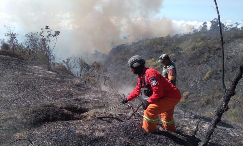
JakartaHits.id — A forest fire on the slope of Mount Semeru in Lumajang Regency, East Java Province, has spread across more than 600 hectares, an area roughly eight times the size of Jakarta’s National Monument (Monas) park, local disaster officials said.
As of Monday, August 31, 2026, firefighting crews were continuing efforts to contain the blaze, with a priority on preventing the fire from advancing toward residential areas and community-owned land, according to the Lumajang Regional Disaster Management Agency (BPBD).
Several active hotspots remain within the Bromo Tengger Semeru National Park (TNBTS), including the Ayak-Ayak block, the Kalimati area, Mount Kolong, and the Trisula Malang junction area, officials said. The size of the affected area continues to change as monitoring and data collection proceed alongside the fire’s spread.
Isnugroho, head of Lumajang’s BPBD, said crews were focused on controlling the direction of the fire, particularly at points with the potential to reach populated areas.
“The fire is increasingly spreading toward Kalimati, then shifting toward Mount Kolong, while hotspots also remain at Ayak-Ayak and the Trisula Malang junction,” Isnugroho said in Lumajang on Monday.
Crews have built firebreaks at several locations to slow the fire’s advance and to prevent it from reaching settlements and community farmland, he said.
The difficult, hard-to-reach terrain on Semeru’s slope has been among the main obstacles facing ground crews, officials said. Meanwhile, a helicopter previously deployed for water-bombing operations over the Semeru fire zone has been redirected to a separate forest fire in Kalimantan, reducing aerial firefighting capacity at the site. (*)